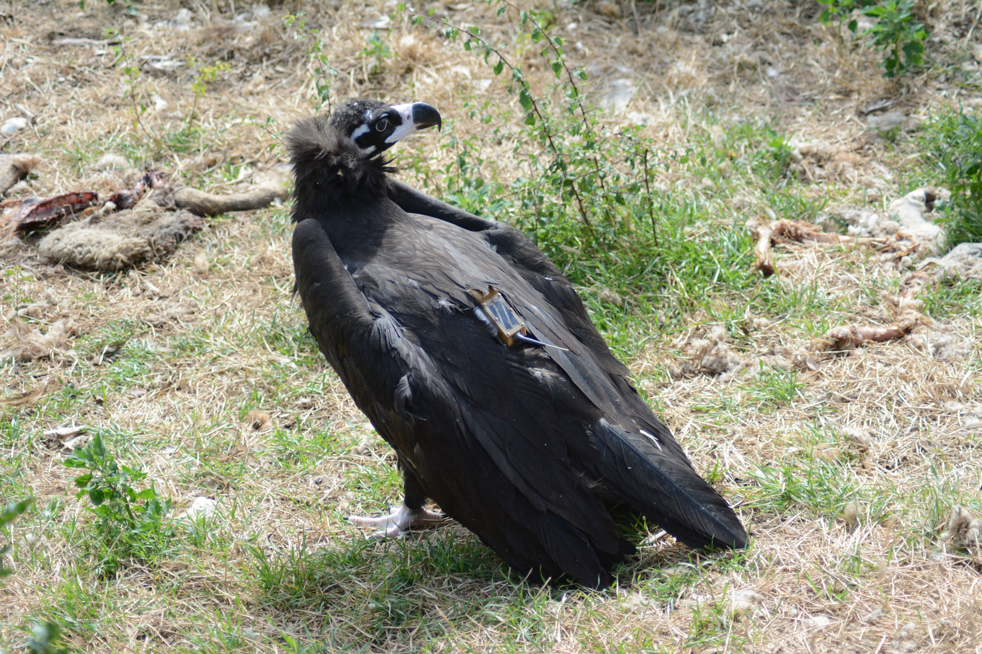
GPS tracking of big birds started in the early 90s and saw an exponential growth in recent years. In the early days, the tags were quite big and were only available with batteries, which meant that only big birds could be fitted with these tags. Today, tags are much smaller and are equipped with solar panels that can recharge the batteries, making them also suitable for smaller birds. Soaring birds like vultures are well suited for these GPS tags, as the weight is not a limiting factor and the tags are well exposed to the sun and are re-charged accordingly. Depending on the type of tag, up to 10,000 fixes per day can be recorded. These data, as well as battery power level, are transferred via satellite or the GSM network to the research teams. The tags can remain operational for several years and it’s not uncommon to follow a single individual for 3-4 years or even longer.
The gathered data feed into several aspects of bird, and more specifically vulture, biology, ecology and conservation knowledge. First, it is a great tool to monitor the well-being of the tagged bird. Conservationists, scientists as well as automated check systems proof the data, which are regularly transferred via GSM/GPRS. If the bird does not move, if body temperature drops low or the accelerometer data show no activity, an alert comes up. Thanks to this information, a field team can be alerted timely to go on site and save a weak vulture or, if they bird is found dead, make sure that a proper post-mortem analysis can be performed, if the carcass is found as soon as possible after the bird dies.
In the Bearded Vulture Gypaetus barbatus reintroduction project in the Alps, 106 birds were tagged with a GPS device, of which 22 died or had to be recaptured. Half of them could be re-released and most likely, most of them would not have been found on time had they not been fitted with a GPS tag (Daniel Hegglin, pers. comm.).
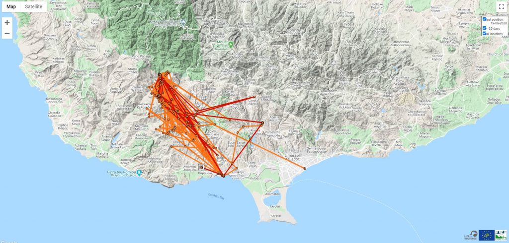
The GPS data further helps us understand foraging areas and migration paths as well as identify dangerous electrical lines, poles or windmills, etc. This data is especially important to inform conservationists where the biggest needs for actions are or for scientists who want to study the behaviour of the tagged birds.
Additionally, GPS data are also a great communication and awareness-raising tool. People can follow the journey of their favourite bird online and high-resolution data can be animated creating impressive illustrations on how birds use thermals and fly in our skies.
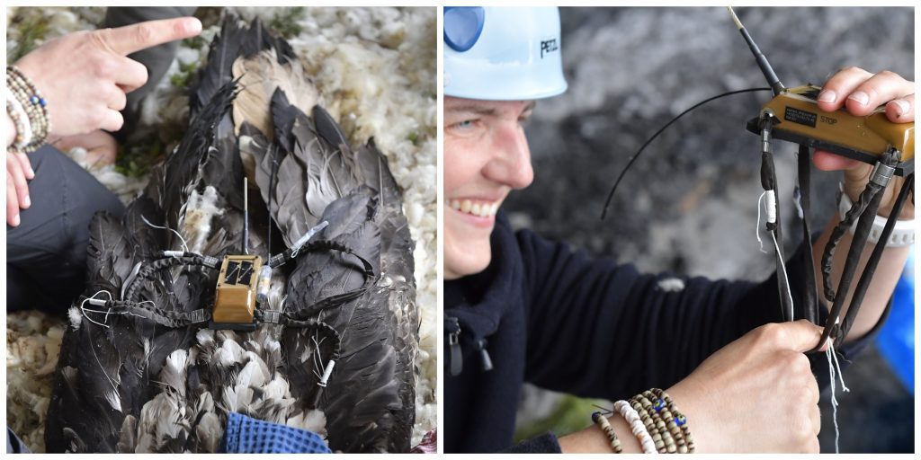
With all these advantages, it is important to remember that fixing the tags on a bird needs to be done very carefully, as wrong fitting of the harness could have severe effects on the bird’s health. Safe methods exist and have been tested widely. It is recommended to add a weak point to the harness, which will break after some years so that tags that are no longer working can fall off.
The Vulture Conservation Foundation (VCF) already provided two tags to BirdLife Cyprus and the Game and Fauna Service, and now we can follow the movements of young Nepheli and Ikaros. Thanks to the GPS tag, the LIFE with Vultures project team were able to realise that Nepheli was roosting in the busy city of Limassol and were able to monitor and protect the bird on the ground. Around 28-35 Griffon Vultures will be tagged within the LIFE with Vultures project using the leg loop harnesses, which is, in our view, the most animal friendly option. We are looking forward to show you some exciting maps for the movement of the resident and translocated vultures in the near future.